Shades and Turkey Run


While Laney and I were waiting for Ben to finish his marathon, we went on a hike to see some of the park's most popular landmarks. It was a short (under 2 miles) hike, but it ended up being mostly steps up a rocky bluff. It took us longer than I thought it would, but we still made it back in time to see Ben finish his race.
Here is Laney looking up at the trail. I wondered what was going through her mind as we climbed up the bluff.


I took a trip to Cathedral Gorge State Park, located in the next town to the south. I figured it would be nice to visit somewhere a little warmer. It was worth the drive.
It was a great place to hike around. It was hard to capture the scale of the formations in photographs.
One of the main attractions at the park are the 'caves'. They are not really caves, but incredibly narrow and tall canyons that sometimes close overhead. Most of the caves were about a foot wide with walls that went straight up for over 50 feet. There were many twists and turns and frequently side passages. It would be a fun place to play hide-and-seek as a kid.


Cathedral Gorge on Wikipedia.
Official Cathedral Gorge site.
The forecast for Friday night was looking suitable, so I decided to spend the night out under the stars. Cleve Creek campground is in Spring Valley up under the Schell Creek range. The sites are located along a little rushing mountain stream.
I could not manage to capture on film how incredible the stars were that evening. I love places when there seems to be more stars than darkness. Not much light pollution out here. You can make out Orion's belt.


Great Basin National Park is just over 60 miles from Ely, NV. It would be less than 40 miles as the crow flies, but you have to cross Connors Pass (7729') and Sacramento Pass (7154'). Here is a picture of Carlos and I birding near the Gray Cliffs.
There was a threat of snow all day, but that didn't dampen our enthusiasm to explore. The rock face in this photo had a several entrances to a cave. The cave itself was closed, but we weren't too tempted anyway when we found fresh mountain lion scat and tracks leading into the cave. It really started to snow on our way back to the car.
After the cave tour, the snow had abated, and we headed up the Wheeler Peak Scenic Drive. It was closed after the Upper Lehman Creek Campground. Both of the campgrounds were empty and were a good place to stroll around looking for birds. The snow was pretty deep in places, well over a foot.


The view out over the Snake Valley was great, with the clouds making shadows on the desert. The mountains in the distance are in Utah.
Towards the evening, another snow storm started to make its way over Wheeler Peak (13,063') and very quickly moved on down the slope. Wheeler Peak is in the center of the photo. It is the highest peak in Nevada, and the second highest point. (The highest point is on the Nevada line with California, and is just the side of a mountain, not a peak.)
The mountains as we make our way back down to Baker and the Snake Valley.
We went down the hill from the Spring Mill Inn to the lake one evening to see the beavers and raccoons. While waiting for the beavers, we took some time to play with the camera. The town of Mitchell, IN provided enough light pollution to capture an image of the Spring Mill lake from the bridge. I would guess that is a planet low in the western sky in the early evening, but I don't know which. If anyone knows, please comment.
 Looking up at Orion. I think it is so cool that the stars move enough in 60 seconds that they don't show up as points, but as arcs.
 Joy had a good time trying to get the technique for light-writing down. At least we don't have to pay for film... The red-color came from holding a flashlight in a closed fist.
Spring Mill State Park is located solidly in Indiana's Karst region, meaning that sinkholes and caves are everywhere. Due to the recent rain, every cave and spring was gushing with water. We could hear the roar from Donaldson Cave from the Inn parking lot. Donaldson Cave
I loved exploring the 'dry side' of this cave as a kid. Now the cave is closed to protect bats from the spread of the White-nose Syndrome. Due to the rushing water, it would have been a challenge to even get there. Joy peering into the entrance of Donaldson Cave.
 A view of Bronson Cave from Trail 3. We found out that the stream that flows through Twin Caves and Bronson Cave is the same stream that exits at Donaldson Cave. Trail 3 heads through Donaldson Woods Nature Preserve, and passes Bronson Cave and Twin Cave. The Twin Cave boat ride is the only cave that is still open to the public within the park. We'll have to go back for that some time. I haven't been since I was little. The old-growth forest in Donaldson Woods Nature Preserve was beautiful.
 I noticed this spring and waterfall while running along the loop. The spring was half-way up the hill and fed the creek that flows west into the lake. It wasn't far off Trail 5.
Last weekend we went to Spring Mill State Park for a little getaway. Our first day we walked around the old pioneer village. Even though the buildings weren't open yet, it was still fun to look around. The dominant structure in the village is the old grist mill, that is still operational. We enjoyed the benefits of the mill when we had the cornmeal pie that night at the Inn.


With Regan in town for the holidays, we made plans to go hiking before the snow melt arrived. Regan, Dad, Dylan, and I headed out to Shades State Park. We pretty much were the only people there.  The Sugar Creek was pretty frozen over, but we restrained Dylan from finding out how frozen it was.
  After descending a steep staircase, Trail 2 follows the ravine back up. The snow actually made it a little easier to keep out of the creek.
 Maidenhair Falls was an icicle.
 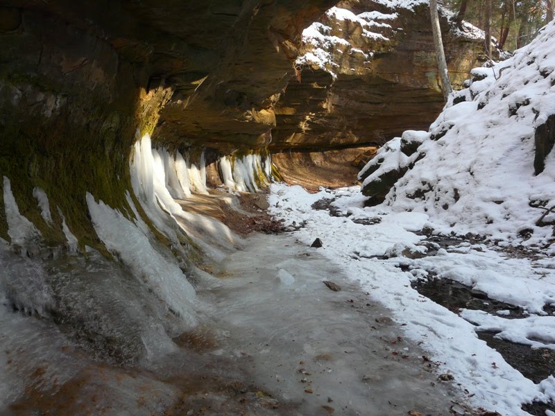 Trail 1 follows a ravine from the Devil's Punchbowl to Silver Cascade Falls.
 Looking out from Inspiration Point over the Sugar Creek valley.
